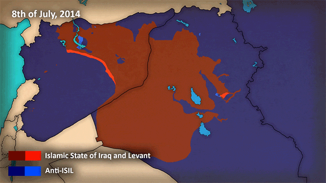

The Islamic State or ISIS or ISIL have quickly rose to power in the regions of Iraq and Syria in the past few years. This map by Peter Ridilla tracks the groups’ spread across the region. The Islamic State is shown in red against the rest of the region, what started off in just a few areas a few years ago has now crossed multiple borders, multiplied itself, and grown terrifyingly fast in recent months.
No comments:
Post a Comment